Welcome to the blog of Fred and Julaine as we chronicle our adventures traveling on Boreas, our Carver 405.


Sunday, July 31, 2011

Day 24 - Pentwater Lake to White Lake - July 30, 2011

We moved from Pentwater Lake to White Lake today.  The distance in Lake Michigan was just over 27 miles and then we went six miles up White Lake to the White Lake Municipal Marina.  It was a very relaxing trip as the sun was out, the winds were light and the waves were almost non-existent.

We passed more dunes today, quite different from any of the dunes we have passed so far.  These were not like the bluffs south of Frankfort or the dunes north of Ludington with the rolling hills of dune grass with small trees and shrubs – these dunes are very bare of vegetation.  It is surprising how different sand dunes along the same lake shore can be from each other.
dunes near Silver Lake (north of Little Sable Point)

Little Sable Lighthouse

entrance to White Lake

White Lake Light Station

sunset on White Lake

Day 23 - Pentwater Lake, Pentwater Municipal Marina - July 29, 2011

We moved 1 mile today – from our anchorage on the northeast end of Pentwater Lake to the Pentwater Municipal Marina.  We wanted to have a chance to walk around the town of Pentwater as neither of us has ever been here.  This is a neat little “up north” town with lots of shops, galleries and restaurants.  A very nice marine store is directly across from the marina.

Thursday, July 28, 2011

Day 22 - Ludington to Pentwater Lake - July 28, 2011

A short trip today, just 14 miles from Ludington to Pentwater Lake.  Although overcast skies are predicted (and perhaps some rain), we are going to anchor out.  We checked out a number of spots around the lake where we are told people anchor, and we finally select the northeast shore of the lake.  The small bays on the south side of the lake (Little Bayou and Big Bayou) are suppose to be good spots for anchoring, but it appears that the home owners around those bays have put out mooring balls for their own boats which makes very little room for anyone else.  Highway 31 runs near our anchorage, so we aren’t quiet and secluded, but it is still beautiful and I’m sure as evening comes, much quieter.
leaving Ludington harbor

the foggy coast south of Ludington

Days 18 through 21 - in Ludington (and Midland) - July 24-27, 2011

We are using Ludington as a base for the boat while we make a very quick trip back to Midland.  We are taking Taylor back home, doing some chores around the house that didn’t get completed before we left and attending a celebration dinner at the Midland Country Club.  We will also be bringing Mark, another one of the grandkids, back with us when we return.  Ludington is just 30 miles from where Fred’s sister lives and they brought us a car to borrow for a few days.

One of the neat things you get to see when you stay in Ludington is the arrival and departure of the Badger, a coal burning car and passenger ferry that crosses Lake Michigan four times a day traveling from Ludington, Michigan to Manitowoc, Wisconsin.  Although the ferry doesn’t save you all that much time (or money) it is a fun way to cross the lake and boarding the Badger is a bit like stepping back in time.
The Badger in its slip in Ludington

The Badger

Taylor in the harbor at Ludington

Day 17 - Arcadia Lake to Ludington - July 23, 2011

Our original plan had been to go from Arcadia Lake to Portage Lake and anchor out another night.  However, when we checked the marine forecast and the radar, we decided to head straight to Ludington.  The radar showed two different storms headed our way, a small one already in Lake Michigan and a larger storm cell covering most of Wisconsin following close behind.  We thought being tied to a dock was a good idea for riding out these storms.

We departed Arcadia Lake under overcast skies with wind on the nose and waves around 2 feet.  The shoreline along this route is more beautiful sand dunes – much shorter than the bluffs north of Arcadia Lake – and with much more character – they are more like rolling hills with dune grass and small trees and shrubs.  Again, not a great day for pictures, but we took a few just to capture the day.  As we got closer to Ludington, the weather cleared a bit and we got some sun.  As you can see, the coast is more beautiful when the sun is out.

Ironically, the storms we saw on the radar managed to miss us almost entirely.  The first storm went north of us and the second one brought only a short 45 minute shower the next morning.
the dunes north of Big Sable Lighthouse

the dunes north of Big Sable Lighthouse

Big Sable Lighthouse

Big Sable Lighthouse
(check out how blue the water is when the sun is shining)

Friday, July 22, 2011

Day 16 - Frankfort to Arcadia Lake - July 22, 2011

We have finally left Frankfort behind.  The weather was overcast in the morning, cleared up and was beautiful by afternoon.  The trip today was short, just under 11 miles.  I took pictures of both Empire Bluff and Arcadia Bluff as we went by – these are spectacular sand dune bluffs rising over 400 feet above the beach.  On a sunny day, the contrast of sky, sand and water is awesome; unfortunately the clouds today didn’t make for breathtaking pictures. 

We were anchored in Arcadia Lake by 11:15am.  We dropped the dinghy and went exploring – first Taylor and I went and then Fred and Taylor.  The guys got some great shots of Boreas at anchor.

Empire Bluff

Arcadia Bluff

Arcadia Bluff

Boreas at anchor in Arcadia Lake

Arcadia Township Marina

Our anchorage at Arcadia Lake

Days 13, 14 and 15 - in Frankfort - July 19-21, 2011

Although we had planned to spend just one more day in Frankfort, we ended up spending three more, thanks to some serious wind from the south (blowing 20-25 and gusting over 30).  We thought that being tied to a dock in those conditions was better than being at anchor which was our next planned stop.  During our extra days we had a chance to ride our bikes around the end of Betsie Lake as well as take a dinghy ride to explore the lake from the water side.  We rode the dinghy part way out the channel on Wednesday and watched the waves crash over the breakwall – we were glad we weren’t out in those conditions. 

On Thursday, our grandson Taylor arrived in Frankfort to join us on the boat for a few days.  We have some short travel days planned and some anchoring out.

Monday, July 18, 2011

Day 12 - in Frankfort - July 18, 2011

We spent the day in Frankfort (well, actually I spent the day in Frankfort; Fred borrowed Dad’s car and made a quick trip back to Midland).  I got in a bike ride along the Betsie River with my sister and I got all our laundry done with no quarters required (thanks, Dad).  We’re spending one more day in Frankfort and we plan to get in a bike ride a dinghy ride and we’ll spend time with my Dad and my sister’s family.

Day 11 - Leland to Frankfort - July 17, 2011

We moved further south today, traveling 37 miles to Frankfort.  The weather was overcast and hazy with winds from the south at 10-15 knots.  That put our travel directly into the waves which was not too bad a direction most of the time.  Occasionally we got to rocking when we encountered the wake of other boats.

The most exciting part of the trip was our encounter with some of the boats competing in the 103rd Chicago to Mackinac Race.  As we left the harbor we began seeing sailboats from the Cruising Classes who had started their race on Friday, ahead of the main group of competitors.  As we searched the horizon for more boats, we spotted a boat that appeared much larger than the others around it.  As it got closer it was obvious it was not one of the Cruising Class boats, and we thought perhaps it was one of the Turbo class boats, so I began taking pictures.  What a thrill it was when we discovered that the boat was Windquest the largest boat participating in this year’s race at 86 feet long.  As you can see from the pictures, this is a truly beautiful boat.
North Manitou Shoal Lighthouse

Windquest

Windquest

Windquest passing by North Manitou Island

Windquest

Point Betsie Lighthouse

Point Betsie Lighthouse

Day 10 - in Leland - July 16, 2011

A second relaxing day in Leland.  As planned we did a bit of boat cleaning and lots of relaxing.  We also took a dinghy ride along the coast outside the harbor.  The shoreline in this part of Michigan is beautiful with white sandy beaches and crystal blue water.  It’s fun to cruise along just off shore and see the huge rocks just below the surface – it reminds us of the power of the glaciers that shaped this area.

Saturday, July 16, 2011

Day 9 - Northport to Leland - July 15, 2011

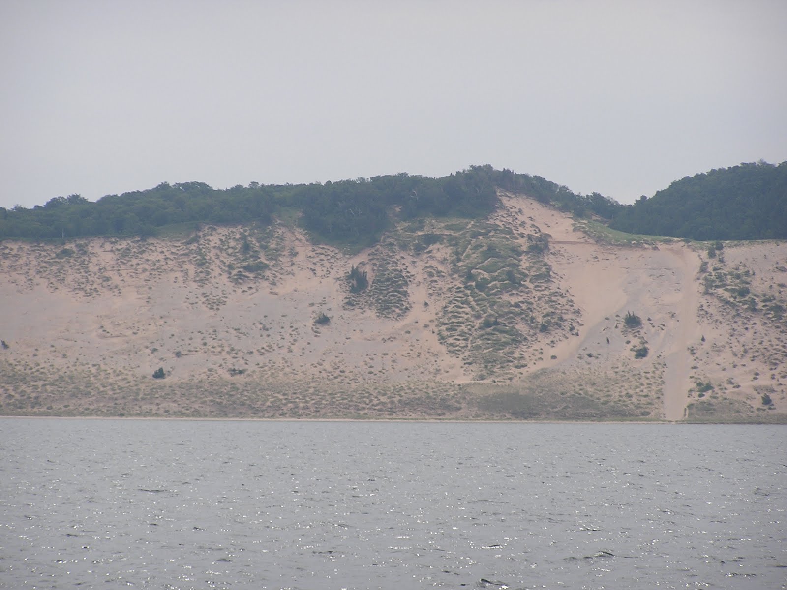
Another easy travel day today – just 26.8 miles around the tip of the Leelanau Peninsula from Northport on the east side to Leland on the west.  Travel distance between these two towns via car is just 12 miles, quite a bit more when you travel by boat.  It was another good day to travel from a wind and waves perspective – there was a very light rain when we left Northport, but it stopped less than three miles out of the harbor.  There was almost no wind or waves and by the time we got to Leland, most of the clouds cleared off and the remainder of the day was beautiful.  One of the great parts about a short travel day is that you have plenty of time to explore your new harbor.

Since Leland is just an hour drive from where my Dad lives, he and Genny hopped in the car and met us here for dinner.  We will be spending the next five or six days in this general area (Leland and Frankfort), so we will have plenty of time for visits with Dad.  My sister and her family are also headed to Dad’s for the next week so we’ll have a chance to visit with them as well.

We’re here in Leland for two nights, so part of tomorrow will be a “work on the boat” day.  The dinghy is going to get cleaned up and we’ll probably do a bit of boat washing as well.
Grand Traverse Lighthouse of the tip of the Leelanau Peninsula

sunset over North Manitou Island

sunset over North Manitou Island

sunset over North Manitou Island

Thursday, July 14, 2011

Day 8 - Charlevoix to Northport - July 14, 2011

We had a very easy travel day today.  Twenty-six miles from Charlevoix to Northport in what I would have to call perfect “powerboat” weather.  There was a very light wind and no waves – if only all travel could be this easy.  Before we left Charlevoix we did take a quick turn into Lake Charlevoix and looked at Oyster Bay where many people anchor.  There were a few boats at anchor and it did indeed look like a nice spot.  The homes around this lake are just as beautiful and spectacular as those around Round Lake.

We filled up all fuel tanks here in Northport as they are by far the lowest we have seen - $3.84 per gallon for diesel.  Gas is higher.  We typically call the marinas along our route a few days in advance to check fuel prices and Northport was the “winner” in this area.

Day 7 - in Charlevoix - July 13, 2011

We spent the day enjoying Charlevoix.  We took a walk along the Pine River and took pictures of the bridge and the Charlevoix South Pier Lighthouse.  We also took a walk past some of the famous Charlevoix “mushroom” houses.  These houses were built by Earl Young in the ‘30s and ‘40s.  The houses look like they just grew out of the ground.  They have cedar shake roof shingles, lots of local stone on their exterior and interesting roof lines with lots of curves.  There are three or four neighborhoods around Charlevoix where you can see these houses.  The ones in the pictures below are two that you can see from Round Lake.

We also took a dinghy ride around Round Lake.  A ride around the lake is a fascinating look at amazing homes, boats and boat houses.
looking from the south pier toward the bridge at Round Lake

the bascule bridge at the entrance to Round Lake

Charlevoix South Pier Lighthouse

a "mushroom" house on Round Lake

another "mushroom" house also on Round Lake

Tuesday, July 12, 2011

Day Six - St. Ignace to Charlevoix - July 12, 2011

We spent a little time with our calendar last night to see when various harbors along the route would be hosting their special summer events and therefore be very busy.  One of our favorite places to stop is Charlevoix City Marina.  The City of Charlevoix hosts a week long Venetian Festival in July and if you want a slip at the marina, you have to book a year in advance.  The Venetian Festival is July 16-23 this year.  That meant we needed to spend time in Charlevoix either before or after their festival.  Last night as we checked the various weather sites, it seemed like we would be spending the next few days in St. Ignace and perhaps need to make stops in Harbor Springs and/or Petoskey on the way to Charlevoix so that we arrived after the festival ended.

However, when we got up, the wind was way down from what was predicted.  We decided to head out and make our way to Charlevoix, spending time there before the festival started.  The first 30 minutes of the ride were beautiful.  The water was calm and there wasn’t much wind.  As we got closer to the Mackinac Bridge, things changed quickly (as they often do in the straits).  The wind picked up and was coming much more west (right on our nose) than the predicted northwest.  We picked up our speed and dealt with the waves and wind that way.  We slowed down to our normal cruising speed as we got to Gray’s Reef and maintained that for almost the rest of the trip.  It was a bumpy ride with the waves coming almost directly at the starboard side of the boat.  That means lots of rocking and rolling for us.

We kicked up the speed once more just before we arrived at the Pine River which is the entrance to Round Lake and Lake Charlevoix.  There is a bascule bridge at the entrance to Round Lake that must open for us to go through.  The bridge opens on the hour and the half hour.  We wanted to make the 3:00pm opening so we didn’t have to wait in the wind and waves for 30 extra minutes.

We are here for at least two nights and will perhaps anchor out in Lake Charlevoix after that.

Mackinac Bridge as we approach from St. Ignace

Mackinac Bridge

Mackinac Bridge as we begin going under

under Mackinac Bridge looking south toward Mackinaw City

White Shoal Lighthouse - north of Gray's Reef - because of its unique
candy stripe paint, this lighthouse is often featured on holiday
greeting cards covered in snow and ice

our view of Round Lake from the upper deck of Boreas looking foward

our view of Charlevoix City Marina out the back of Boreas

Monday, July 11, 2011

Day Five - Cheboygan to St. Ignace - July 11, 2011

We had a short travel day today, just over 18 miles from Cheboygan to St. Ignace. We didn’t start until 12:45pm as there were rain showers working their way through Cheboygan and the Straits of Mackinac in the morning. It was very overcast and quite foggy with very little wind for most of the trip. As we began to pass Mackinac Island, the wind picked up quite a bit, but the fog/haze remained. In fact, we could just barely see the Mackinaw Bridge – not a good day for taking pictures of this fabulous bridge. Hopefully when we depart from St. Ignace heading into Lake Michigan it will be better for photos.
The Grand Hotel on Mackinac Island - as seen through the haze

Two ferry boats pass on their way to and from Mackinac Island

Sunday, July 10, 2011

Days 3 and 4 - to Cheboygan - July 9-10, 2011

Saturday was another travel day.  The short term forecast showed some potential rain and thunderstorms for Sunday and Monday, so we decided to move Saturday knowing we may not move for a couple of days.  The wind was from behind the entire trip from Presque Isle to Cheboygan with waves from 2-3 feet.  The Autopilot had trouble steering, so we traded off steering every half hour and gave the Autopilot a break for the day.  The best part of steering was the chance to surf the waves.  A good surf got the speed up into the 9.7 to 9.9 knot range with my best surf of the day at 10.4 knots.  Although Boreas is a displacement hull and can move right along, we tend to stay at around 1200 RPMs to keep fuel consumption at a reasonable rate.
Cheboygan County Marina

Boreas at the Cheboygan County Marina

Boreas at the Cheboygan Country Marina
Cheboygan County Marina is a great place to stay, only 15 mile from Mackinaw with great service provided by harbormaster Curtis Chambers and his staff.  We stayed a second night and spent Sunday doing boat chores and laundry.  We had quite a bug fest the last two travel days and the boat needed a good cleaning.  We got a lot of cleaning done, but there is still a bit more to do.

Saturday, July 9, 2011

Day Two - East Tawas to Presque Isle - July 8, 2011

Thunder Bay Island Light
Today was a long travel day - 77 nautical miles. The travel was relatively easy, very calm at the start with only short choppy waves for the last couple of hours. We have done this coast of Lake Huron so many times that we forget how beautiful it is. Although we stay quite far off shore to avoid shallow water and large rocks, we did get photos of three of the lighthouse we passed on today’s trip. 

Middle Island Light

Old Presque Isle Light
We have already managed to use our alternate transportation sources (our bikes and our dinghy) during this trip. We rode our bikes from the dock in East Tawas to the Tawas State Park and back and we took a dinghy ride to visit friends who were anchoring across the bay here in Presque Isle.